May 15, 2026
From Need to Delivery: How a Laser Scanning Project Progresses from Start to Finish
A laser scanning project is not simply a one-day measurement visit. It is a process in which every phase affects the quality and usability of the final deliverable. A well-defined need, clear communication and the right technical implementation help ensure that the data serves its intended purpose long after the project itself has been completed.
When a need for laser scanning arises, the project usually starts quickly. First, we clarify what needs to be scanned, how the data will be used and when the final deliverables are needed. After that, the right implementation method is planned, the actual fieldwork is carried out, the data is processed and the material is delivered to the customer in the agreed format.
The Project Starts by Defining the Need and Intended Use
A laser scanning project usually begins with the customer’s initial contact. The first discussions are held with SolidComp’s sales team or management, after which the project moves into more detailed planning and implementation.
From the perspective of scanning, the most important early questions concern the purpose, scope and schedule of the work. These are clarified together with the customer before the work begins. The better the initial information the customer can provide, the more smoothly the project can be planned and carried out.
One key question is how the scanning data will be used. The intended use directly affects the choice of scanning technology, required accuracy and delivery formats. If the data is needed as source material for design, the accuracy and formats required may differ from those needed for general visual documentation. At the same stage, we also assess whether the customer needs a surface model, 3D modelling, Reality Twin or other post-processing services in addition to the point cloud.
Technical requirements, such as accuracy, should also be defined as early as possible. In the field, it is useful to review the scanning targets together and identify any areas that require special attention or more detailed scanning than usual.
Scope Depends on More Than Floor Area
When estimating the scope of a project, floor area alone does not provide enough information about the actual amount of work required. An open 500-square-metre hall is much faster to scan than a hall of the same size containing a four-level machine, extensive pipework and equipment, ongoing demolition work, office spaces and only one access route.
This is why it is useful for the initial information to describe the site’s special characteristics as well. Are there hazardous areas, tank work or other special requirements? Is the space open, or is it full of equipment, structures and loose items? Are control points already available, or do they need to be measured separately? Does the data need to be tied to a coordinate system? These factors affect how much time should be reserved for scanning and how many people are needed on site.
Scanning density directly affects scanning time. If the aim is to produce a general overview, scanning can be carried out with fewer positions. If the aim is to minimise blind spots around a specific piece of equipment, pipeline or production line, more scanning positions will be required.
The Schedule Also Guides the Choice of Method
The project schedule affects both the scanning method and post-processing. If the data is needed quickly, some more labour-intensive post-processing options may have to be ruled out. For example, extensive 3D modelling will usually not be completed within a few days, even if the scanning itself can be carried out quickly. Time must also be reserved for producing different formats, combining datasets and checking data quality.
In some projects, it is sufficient to deliver a point cloud or another agreed basic dataset to the customer. In other cases, more detailed modelling, surface models, calculations, reports or the transfer of data into the Reality Twin environment are required. The more extensive the final deliverable, the more time is needed after the fieldwork.
Is Reality Twin Needed Now or Later?
Not every scanning need requires the immediate deployment of Reality Twin. Many customers initially need scanning data for a single project, such as a construction or modification project. In such cases, the need may be limited: the data is used for design, inspection or documentation, and there is not yet an immediate need for a broader visual management environment.
Over time, however, scanning data often accumulates from several different projects. This can create a need to manage, view and use the data centrally. Reality Twin becomes particularly valuable when different types of data, such as point clouds, surface models, 3D models, images and documentation, need to be brought into one visual environment for use across the organisation.
Planning Is Based on the Customer’s Source Material
The planning of a laser scanning project is largely based on the source material provided by the customer. This may include photographs, floor plans, previous scan data, control point lists, area maps, safety instructions and information about the operational status of the site.
The source material affects what is done in the field. If the site turns out to be different from what was expected based on the preliminary information, this may affect the schedule and scope of work. For example, a general scan of an empty production space is much faster to carry out than a more detailed scan of the rolls of a paper machine.
In a general scan, the spaces are covered comprehensively, but more blind spots may remain behind individual pieces of equipment. In more detailed scanning, the aim is to minimise blind spots around a specific machine, pipeline or process area. Most projects are not purely one or the other; typically, the customer wants a general scan of the whole area and a more detailed scan of a selected target.
This is why the targets and priorities should also be reviewed with the customer in the field. This ensures that the scanning focuses on the right areas and that the data matches its intended use.
Coordinate Systems and Control Points Ensure Future Use
If the data needs to be tied to a coordinate system, control points must be available in the area. If they do not already exist, they must be measured before or during the scanning. This is often done by a SolidComp scanning specialist.
Coordinate-based data is particularly important when the scanning data is to be used in future projects, combined with earlier datasets or supplemented later. A good reference framework makes later scans easier and ensures that different datasets align correctly within the same overall model.
Before the fieldwork, training and inductions may also be required. In industrial sites, access may require safety training, work permits, access permits, driving permits or special protective equipment. These are clarified and arranged in advance together with the customer.
Timing Is Often Determined by the Customer’s Operations
In many locations, laser scanning can be carried out almost at any time. In industrial environments, however, the timing is often determined by the customer’s operations, production, shutdowns or other ongoing work. Nature also has its own impact: winter and snow may cause unusual moisture, steam or temperature conditions, and especially when scanning outdoors, darkness, rain, wind and freezing temperatures affect scanning conditions. For example, drone imaging cannot be carried out in strong winds, and heavy rain causes droplets that interfere with scanners. Snow, in turn, creates a false representation of the ground surface.
In some sites, scanning can be performed while production is running. In other cases, it is necessary to wait until production is stopped or a specific area becomes available. If demolition, installation or maintenance work is taking place at the site, scanning must be scheduled around these phases.
For this reason, every project is different in practice. A laser scanning project is largely carried out according to the customer’s schedule and the requirements of the site.
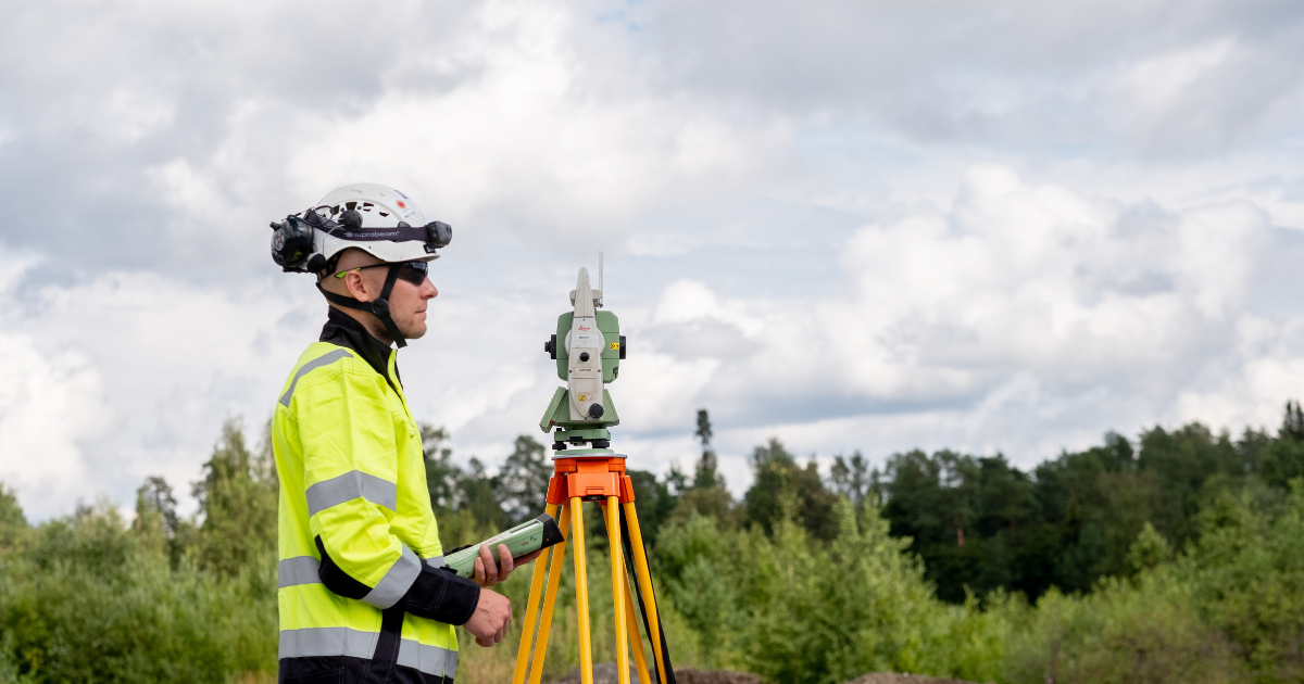
What Happens in the Field on the Scanning Day?
A typical scanning day begins before the team even arrives at the site. The people going into the field know in advance what they are going to scan, when they need to be there and where the site is located. The equipment and tools are usually checked and prepared the previous day. In the morning, the vehicle is packed and the team leaves for the site.
The customer’s contact person is known, and the necessary permits and safety matters have either been handled in advance or are checked at the gate. When access arrangements are in order, entering the facility is as smooth as possible.
At the site, the scanning areas are first reviewed with the customer. At this stage, it is still possible to clarify whether a certain area is especially important, whether there are restrictions at the site or whether changes are expected during the day. After this, the actual measurement work begins.
A typical division of work is that one person measures points for the scans while another performs the scanning. The exact division of work depends on the site, the technology used and the requirements for the data. Once the measurements have been completed, the customer is informed that the work is finished. Finally, permits and any borrowed items are returned, the equipment is packed, and the team returns to the office or continues to the next site.
A One-Day Assignment Can Be a Long Process
If the site is located in Finland, for example three to five hours away by car, the working day often starts very early. Departure may be around six in the morning. The team arrives at the site during the morning, and by lunchtime the scanning targets have usually been reviewed and the work has begun.
Depending on the scope of the work, scanning may be completed in the afternoon or early evening. The return to the office can extend into the evening, after which the data is unloaded, processing is started and the vehicle is unpacked the same day. One-day projects are usually small or medium-sized assignments, involving anything from dozens to a few hundred scanning positions.
In multi-day projects, the team stays overnight in a hotel. The structure of the day is otherwise similar, but there are more active scanning hours because the work can begin directly at the site in the morning without a long drive.
Safety Is Part of the Implementation
Safety is taken into account throughout the project. This means using the correct and undamaged equipment, following site instructions, maintaining personal awareness and, where necessary, using special protective equipment defined by the customer.
If the site requires special arrangements, areas can be restricted and isolated. Where conditions require it, meters and other safety-related equipment are also used. In industrial sites, the customer’s safety regulations and the situation at the time are always followed.
The customer also plays an important role in ensuring safety and smooth implementation. Before the assignment, the customer provides the necessary source information, communicates any training or other requirements, and handles access and driving permits on their side.
Data Processing Begins After Fieldwork
Once the fieldwork has been completed and the team returns to the office, data processing begins. The raw data is first processed in the equipment manufacturer’s own software. After this, the scans are assembled and linked together.
At the same time, target points, control points and any drone images can be processed. Once the data has been assembled and tied to the coordinate system, exporting begins, meaning the data is converted into the agreed delivery formats.
Point clouds are exported from the scanning software, after which the data can be further processed in other programs. If a surface model is delivered to the customer, the point cloud can be meshed. In simple terms, meshing means turning the points into small triangles, or a mesh. This creates a surface model.
Point clouds can also be converted into other formats according to the customer’s needs. Drone images can be combined with a surface model, making the overall dataset more comprehensive, especially for outdoor areas. Solid 3D modelling is carried out based on the point cloud after the data has been assembled and checked.
Data Can Be Brought into Reality Twin
Surface models, 3D models, point clouds and images can be used in Reality Twin. In practice, the datasets are loaded into the same environment, where they can be viewed together.
In Reality Twin, the user can, for example, inspect the scanned site, take measurements, compare different datasets, use images and connect other information to the model. This makes the data easier to use, especially when the same data is needed for several different tasks or by different roles within the organisation.
In this way, laser scanning data does not remain merely a file from a single project. It can become part of the broader digital documentation of a production facility.
Read more: Implementing Reality Twin
What Does the Customer Receive as the Final Deliverable?
As the final outcome of the project, the customer receives dimensionally accurate data from the scanned site. The delivery format is defined according to the needs of the project. SolidComp can deliver a wide range of different formats, the most common of which include:
- Point clouds: E57, PTS, PTX and Recap
- Surface models: NWD, OBJ and STL
- 3D models: DWG and STEP
- Images: 360° images, bubble views and ordinary photographs
- Other formats and data: Reality Twin, Scene2go viewer, Aveva LFD, possible calculations and reports, and lists of points measured in the field
The data can be used for many purposes. It can support the design of new installations, dismantling of old structures, logistics planning, checking of dimensions, personnel training or the presentation of investment plans to management and other stakeholders.
What Affects the Schedule and Cost?
The duration of the project is affected by the size of the dataset, the number of scans, the location of the site, the selected scanning technology and the required post-processing. The number of scans also affects the price. If the site is far away, travel costs increase the overall cost.
Choosing the right scanning technology can save the customer costs in both fieldwork and travel. For example, in large general scanning projects, mobile scanning may be an efficient option, while sites requiring more precise measurement can be scanned with a tripod scanner.
In the long term, laser scanning can be particularly worthwhile if the first project creates a good measurement foundation. Once a large part of the factory or area has already been scanned and tied to a coordinate system, future projects can be carried out more quickly and efficiently.
Previous Data Speeds Up Future Projects
When high-quality previous data exists for a site, it can be used in subsequent scans. New data can be tied to the previously scanned whole, which speeds up the entire process both in the field and during post-processing.
For example, if comprehensive scanning data already exists for an entire factory area, supplementing one new area is considerably lighter than starting from scratch. In some cases, a surveyor may not be needed in the same way as in the first project if the basic framework and coordinate system are already in place.
The first project does not need to be large. However, if it is known that additional scans will be carried out in the area later, it is worth considering measuring a slightly broader foundation from the start. This can also be taken into account in practical scanning work, for example by scanning doorways and connections between areas so that datasets can be combined more easily later.
What Separates a Comprehensive Service from a Single Scanning Assignment?
Laser scanning services can be purchased on a highly project-specific basis: one area is scanned for a specific project, the customer receives a point cloud, uses it in that project and then moves on. This approach can work for a single need.
The problem often appears later. If point clouds from different projects remain in individual people’s folders, project repositories or hard drives, finding and using them becomes difficult. There may be hundreds of gigabytes of data, but the organisation may not know what has been scanned, how up to date the data is or who can use it.
Reality Twin’s answer is to bring this data within reach of the entire facility and make it usable, rather than leaving it to gather dust in a drawer. When scan data, models and images are available in a shared visual environment, maintaining factory documentation becomes easier and existing data can be used in new projects.
Previous scanning data from the customer can also be brought into Reality Twin regardless of who originally scanned it. This is particularly useful when the customer already has a lot of measurement data, but it is not centrally available.
A Point Cloud Is Often Only the Starting Point
Delivering only a point cloud may be sufficient if the customer has the internal expertise and tools to use it. Often, however, the customer may also need a surface model, 3D model, analysis services or the transfer of the data into a clearer operating environment.
If these services must be purchased from different providers, the customer’s workload increases. This is why it is practical to obtain post-processing and delivery formats suited to different use cases from the same place as the scanning data.
In purchasing decisions, price and fast delivery are often key factors. Basic scanning is a competitive service and can often be delivered relatively inexpensively. In the long term, however, a point cloud is a long-lived product whose value increases if it can also be used later, for example in 3D modelling, surface and area models, design, maintenance and plant documentation.
For this reason, a more comprehensive option may be justified even if the initial price is higher than for scanning alone. The important point is to assess what is needed from the data now and what may be needed from it in future projects.
A Good Laser Scanning Project Also Serves Future Use
A laser scanning project progresses in stages: the need is defined, the project is planned, the fieldwork is carried out, the data is processed and the material is delivered to the customer in the agreed format. Every phase affects how usable the final result is.
At its best, laser scanning is not just a single measurement project, but the beginning of broader and long-lasting digital documentation. When the data is produced to a high standard, tied to the right coordinate system and delivered in a format suited to its intended use, it can be used again and again in design, maintenance, safety, training and decision-making.
A good project therefore does not end when the scanning is completed. Its value is seen in how easily the data can be used in the next project, the next inspection and the next decision.
Subscribe to SolidComp’s Newsletter
Receive a newsletter from SolidComp about once a month. In it, we share the latest updates from the industry, SolidComp, and the SolidComp Reality Twin.
Subscribe newsletter