May 12, 2024
Why keep your laser scanning data tucked away in a drawer when you could be getting ten times the value from it?
You’ve heard that there are extensive laser scanning data sets for your production facility, but have you used them yourself? In this article, we’ll show you how data collection should be conducted to ensure you get the maximum return from laser scanning.
Are there alternatives to CAD based production facility models?
CAD models are invaluable in greenfield projects, but they have been considered the only correct way to also maintain a production facility model. From the perspective of decision-making regarding existing industrial environments, however, CAD models are ultimately simplifications. It’s hard to trust their dimensional accuracy and currency. Utilizing CAD models in daily operations is also challenging without experience in design software.
Laser scanning is the key to successful as-built documentation
The differences between high-quality laser scanning and 3D modeling can be illustrated by comparing their use in as-built documentation. Let’s use a large, nearly completed investment project as an imagined example.
It’s not to say that the construction and installations would exactly match the plans. On-site, corners often have to be cut due to circumstances. In an ideal situation, inevitable deviations are documented in the as-built model delivered to the production facility.
Problems arise immediately when the CAD model is dug up for modification projects: It’s noticed that the realized pipe and cable routes have not been updated, and the new plans have collisions.
However, as-built documentation can fall short because modeling is so labor-intensive. And once production has started, it’s easily forgotten. Problems arise immediately when the CAD model is dug up for modification projects: It’s noticed that the realized pipe and cable routes have not been updated, and the new plans have collisions.
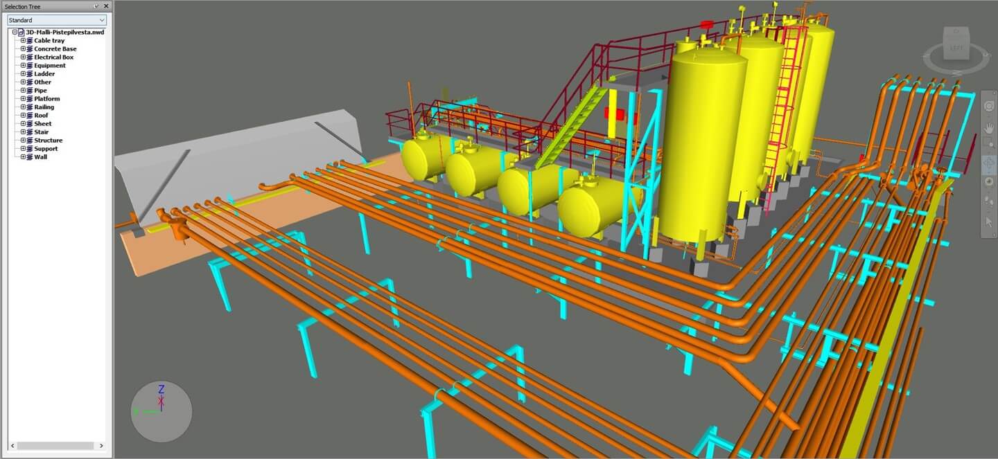
When as-built documentation is meticulously carried out through laser scanning, a cost-effective, precise overview of construction and installations is achieved. The resulting accurate and visual materials are also immediately applicable in the daily operations of the production facility.
In a freshly built production facility, the materials we generate are particularly useful for operations and maintenance, work safety, training, and guidance, but sooner or later, they will also be sought after in design.
Savings start from an accurate production facility coordinate system
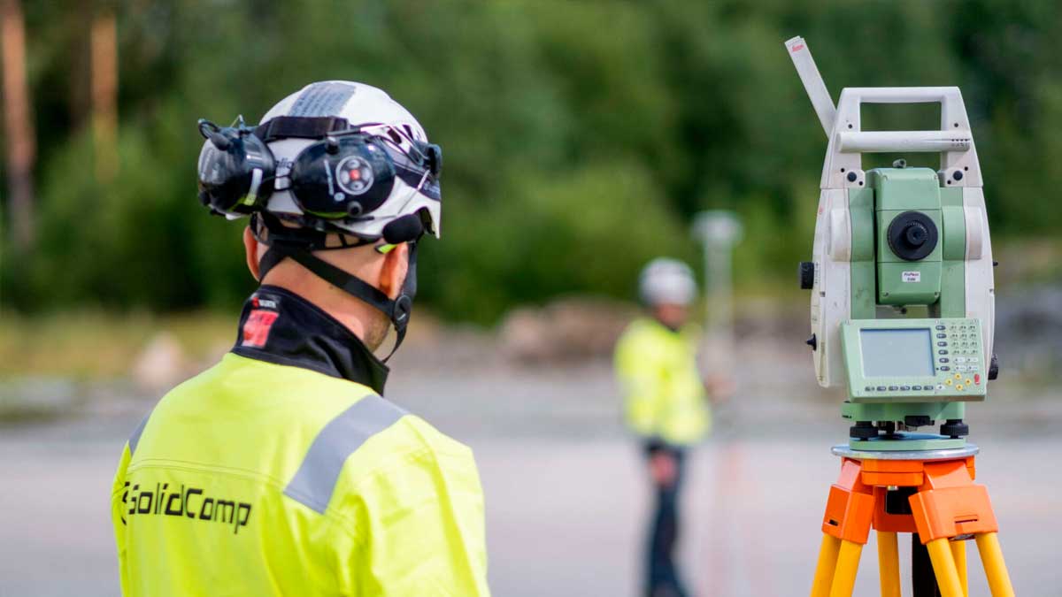
Laser scanning is an unmatched 3D measuring method. However, before grabbing the scanner, we always ask our client: To which coordinate system will the data be bound?
A precise and well-documented coordinate system is an unbeatable factor for creating and maintaining a long-lasting production facility 3D model. It ensures the placement of all measurement and 3D data for decades.
For example, when a perfectly accurate pipe bridge design is visually presented to installers, you can confidently start construction. The bridge ends will meet seamlessly in the middle.
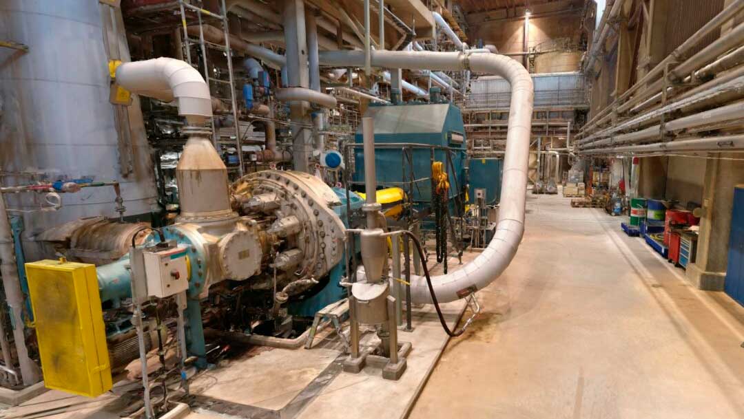
Laser scanning captures the current state quickly and efficiently
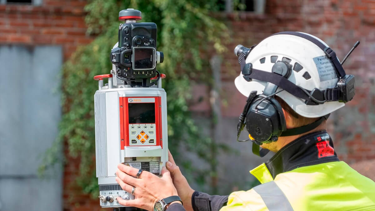
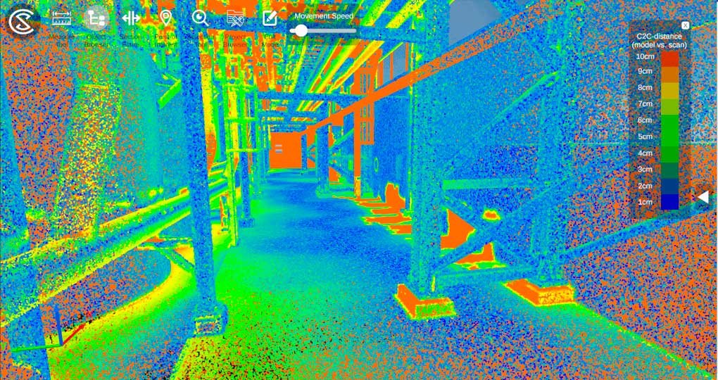
Compared to 3D modeling, the advantages of laser scanning include its cost-effectiveness, accuracy, and visuality. When measuring, the laser scanner automatically emits millions of laser beams into its surroundings. As the beams bounce back, the scanner captures various data about the obstacles encountered, such as coordinates. In the processing phase, the data is bound to the production facility’s coordinate system.
We almost always perform laser scanning in color. Our terrestrial laser scanners are devices from Faro and Riegl. We also use NavVis’s VLX mobile laser scanner, which can capture environments up to 10 times faster than terrestrial laser scanners. A significant added benefit comes from the high-quality 360-degree images that our devices capture of the environment during the scanning process.
The costs of laser scanning are distributed among all users of the data, maximizing your return on investment.
We have refined our data collection and processing processes so that production facilities can utilize the materials we produce as diversely and effortlessly as possible. Along with the materials, we provide the necessary tools for their easy utilization.
The result is a 3D model that accurately reflects reality everywhere the laser scanner has been. You can use the resulting data in design, maintenance, safety, training, and guidance. The costs of laser scanning are shared by all users of the material, ensuring you get the maximum return on your investments.
Read about how you can easily utilize and maintain all your production facility’s 3D materials with our Reality Twin™ solution
What should you remember from this article?
- Maintaining a production facility model starts with an accurate and well-documented coordinate system
- As-built documentation should utilize laser scanning
- In maintaining a production facility model, laser scanning is more precise and visual than CAD modeling. It’s also more useful to all employees and stakeholders.
This article addresses laser scanning. In our upcoming articles, we will explain how, with the help of Reality Twin™, laser scanning models can contain even more information than CAD models and how they are utilized in various functions.
Would you like to contact us? Leave us a message, and we will respond soon.
Subscribe to SolidComp’s Newsletter
Receive a newsletter from SolidComp about once a month. In it, we share the latest updates from the industry, SolidComp, and the SolidComp Digital Twin.
Subscribe newsletter