May 13, 2026
From Point Cloud to 3D – Laser Scanning in Industry
Laser scanning, also known as laser surveying or 3D laser scanning, is an established method for capturing accurate three-dimensional data from physical environments. This article introduces the basics of laser scanning: how it works, the different scanning methods available and where it can be used.
Laser scanning is widely used in industry and construction, for example in the planning of construction and modification projects and in the lifecycle maintenance of entire production facilities.
The strength of laser scanning lies in its ability to capture an existing environment in a dimensionally accurate, fast and cost-effective digital format. When up-to-date and reliable 3D data is available from a physical site, it can be used in design, inspections, documentation, training and decision-making without the need to verify everything on site.
How Does Laser Scanning Work?
In laser scanning, an existing environment is captured as a digital point cloud. A laser scanner uses laser measurements to record a large number of points from its surroundings. These points form a three-dimensional point cloud that corresponds to the real object or environment in scale.
A point cloud is not yet an actual 3D model. It consists of individual measured points. These points represent the surfaces, structures, equipment and surroundings detected by the scanner. When there are enough points, the result is a highly accurate digital representation of the scanned space.
Compared with a total station, a laser scanner measures so-called “dumb” points. By default, the points do not contain information about what object they represent; they are measurement points relative to the scanner’s position. The actual meaning, such as whether a point represents a piece of equipment, a pipe, a platform or a structure, can be added later during processing, modelling or, for example, in the Reality Twin environment.
Laser scanning makes it possible to scan even large areas quickly and accurately. The method is particularly well suited to locations where reliable information about the existing environment is needed, but where traditional measurement would be slow, difficult or challenging from a safety perspective.
Different Types of Laser Scanners and Their Uses
There are different types of laser scanners, and they use different measurement techniques. The right method is always selected based on the intended use, required accuracy, size of the site and schedule.
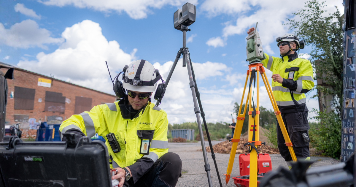
A tripod-mounted laser scanner measures the environment from one scanning position at a time. The scanner rotates 360 degrees and, depending on the device settings, can measure around 30 million points from a single scanning position. By combining several scanning positions, blind spots in the point cloud can be reduced and the overall model made more accurate.
Tripod scanners typically achieve millimetre-level accuracy. This makes them well suited to general scanning of industrial facilities, more accurate measurement of equipment, documentation of objects such as crushers and mills, and situations where measurements need to be reliable for design or installation verification.
Portable and mobile scanners, by contrast, measure continuously while moving. Their advantage is speed: large areas can be captured much faster than with individual tripod scans. However, their accuracy is usually lower, typically at centimetre level. For this reason, mobile scanning is well suited to the rapid general scanning of office spaces, access routes, general factory areas or large spaces.
Scanners often also capture photographs during measurement. These images can be used to colourise the point cloud and for general visual review. When a dimensionally accurate point cloud and a photographic view complement each other, the data is easier to interpret, including for users who do not work with measurement data or 3D models on a daily basis.
What Can Be Done with a Point Cloud?
A point cloud consists of a large number of measured points that are in the same scale as the real environment. It can be used to inspect a site from different angles on a computer and to measure distances without a new field visit.
Plans can be brought on top of the point cloud, allowing users to assess how new structures, pipe routes, equipment or other changes fit into the existing environment. A point cloud can also be used to compare completed installations against the original plans. This makes it possible to check whether the implementation corresponds to the design and whether documentation needs to be updated.
A point cloud can also be used as the basis for 3D modelling that corresponds to reality. In practice, this means modelling 3D objects based on the point cloud so that they match the scanned structures and equipment. Such a model can be useful in design, modification work, clash checks and documentation.
The points can also be triangulated to create a surface model. A surface model makes the object visually more coherent and easier to handle, but because of the triangulation process it is usually slightly less accurate than the original point cloud. The intended use therefore determines whether the most suitable data type is a point cloud, a surface model, a separately modelled 3D model or a combination of these.
Reality Twin enables different types of data to be viewed in the same environment. Point clouds, surface models, 3D models, 360° images, photographs and plans can be reviewed side by side, giving the user an overall view of the site and the information related to it.
What Types of Data Can Be Delivered from Laser Scanning?
As the outcome of a laser scanning project, the customer receives dimensionally accurate data from the scanned site. The delivery format is selected according to the intended use. Common deliverables include:
- Point clouds: E57, PTS, PTX and Recap
- Surface models: NWD, OBJ and STL
- 3D models: DWG and STEP
- Images: 360° images, bubble views and ordinary photographs
- Other formats and data: Reality Twin, Scene2go viewer, Aveva LFD, possible calculations and reports, and lists of points measured in the field
The data has many possible uses. It can be used for designing new installations, dismantling old structures, logistics planning, checking dimensions, training personnel and presenting investment plans to management and other stakeholders.
Industrial Use Cases for Laser Scanning
It is difficult to define strict limits for the use cases of laser scanning. It can be used in almost any situation where reliable information about an existing physical environment is needed.
At the beginning of an installation project, laser scanning can be used to create dimensionally accurate documentation to support design. When designers have access to up-to-date 3D data, the compatibility of pipework, equipment, access routes and structures can be assessed before implementation begins.
During a project, laser scanning can be used to monitor progress and document changes. At the end of the project, it can be used to verify that the completed installations correspond to the plans. If necessary, the documentation can be corrected to reflect reality, so future projects are not based on outdated information.
Savings can be significant already at the beginning of a project if reality-based 3D data helps avoid issues such as clashes, incorrect dimensions or unnecessary verification visits. Laser scanning data can also be used in personnel and stakeholder training and to reduce the need to go into the field simply to check dimensions or locations.
Laser scanning is often faster than traditional measurements made with tape measures and photographs. The method makes it possible to inspect the dimensions of a building, device or production environment from a computer and from several perspectives. This reduces the number of site visits and makes work easier, especially when the target is located at height, in a confined space, in a hazardous environment or in an area that can only be accessed when production is stopped.
Differences Between Laser Scanning Methods and Complementary Technologies
Different measurement and documentation methods have their own strengths and limitations. This is why several technologies are often combined in the same project.
Tripod Scanning, or Traditional Laser Scanning
Tripod scanning is a traditional and highly accurate laser scanning method. It is suitable for general scanning in industry as well as for objects that require more precise measurement.
Its advantages include millimetre-level accuracy, strong geometric reliability and suitability for demanding industrial environments. Tripod scanners also measure over long distances: typically to around one hundred metres, and with some devices considerably further. They also capture photographs that can be used for point cloud colourisation and site review.
The limitation of the method is that it is slower than mobile scanning, because scans are taken from individual positions. In large locations, several scanning positions are required to minimise blind spots.
Read more
Mobile Laser Scanning
Mobile laser scanning is particularly well suited to the rapid general scanning of large areas. Because scanning takes place while moving, large spaces can be captured quickly and cost-effectively.
The accuracy of mobile scanning is usually at centimetre level, so it does not replace tripod scanning when millimetre-level measurement accuracy is required. Instead, it is well suited to situations where the most important requirement is to obtain a comprehensive general view of spaces, access routes or large areas quickly.
Mobile scanning can also include photographs, which improve the interpretability of the data and help identify objects.
Read more
Handheld Scanners
Handheld scanners are suitable for the accurate scanning of small objects. Their advantage is that the device can fit into confined spaces where a larger scanner may not be practical.
The accuracy can be at millimetre level, but the use case is usually limited. A handheld scanner is mainly needed for detailed scanning of small objects. In many industrial use cases, a tripod scanner can replace a handheld scanner, because it provides accurate data from larger areas as well.
Ground-Penetrating Radar
Ground-penetrating radar, or georadar, is used to locate and model underground structures such as pipes, cables and other hidden objects. It is a useful method when planning excavation work, new foundations or modifications in yard areas.
In older factory areas, there may be little or no reliable information about what has been built underground in different locations over the past 100 years. Up-to-date and reliable drawings and documentation may be missing. In such cases, ground-penetrating radar is the most effective way to bring the information reliably up to date.
However, ground-penetrating radar results require interpretation. The data is not as straightforward as laser scanning of a visible environment, and assessing the results requires experience and expertise.
Read more
Drone Imaging and Photogrammetry
A drone does not technically scan; it takes photographs. Based on these images, photogrammetry can be used to create three-dimensional surface models and area models. The method is particularly suitable for outdoor areas such as factory yards, roofs, tank tops, façades and large areas that would be difficult to document from the ground alone.
The advantages of drone imaging include the rapid capture of large areas and a rich visual dataset. Accuracy is usually at centimetre level. Drone data can complement laser scanning when the different datasets are tied to the same coordinate system. This also makes it possible to capture objects that cannot be reasonably or safely measured using ground-based scanning alone.
Read more
Gaussian Visuals Brings a Photographic View to Industrial Environments
Gaussian Visuals is a new, nearly photographic view in SolidComp Reality Twin. It uses Gaussian splatting technology to present a production facility as a highly realistic, navigable 3D environment. With current technology, achieving Gaussian Visuals-level results requires laser scanning with a scanner specifically designed for this purpose, so this need should be taken into account already during the planning phase of a laser scanning project.
The method is based on millions of Gaussian “splats” that reproduce colours, depths, shading and textures. The result is a visually clear and easy-to-interpret view in which equipment, spaces and structures are easy to recognise and place in the right context.
Gaussian Visuals does not replace a dimensionally accurate point cloud, surface model or other technical data; it complements them. Its strength lies in visual fidelity and clarity. When an environment looks familiar and realistic, it is easier to use in discussions, planning, training and collaboration between teams and partners.
Read more
How Is the Right Scanning Method Selected?
The right scanning method depends on what the data will be used for. Is millimetre-level accuracy needed as design input? Is the aim to obtain a quick general view of a large area? Is a model of outdoor areas required, or do underground structures need to be located?
In practice, the best solution may be a combination of several methods.
For example, the documentation of an entire paper mill could be carried out using a hybrid approach. The indoor areas would generally be scanned with mobile scanning so that a comprehensive overall view can be captured quickly. Areas that require more accurate data would be scanned with tripod scanners. For example, the surroundings of the paper machine could be measured more accurately, while mobile scanning might be sufficient for other levels.
The outside of the building and yard areas could be captured with a drone. Blind spots, such as the spaces between tanks, would be supplemented with ground-based scanning. Yard areas could also be complemented with ground-penetrating radar if there is a need to locate underground structures.
All datasets would be tied to the same coordinate system, for example using a total station or GPS. This makes it easier to combine the datasets and enables the site to be supplemented later. If a specific area later needs to be measured more accurately with tripod scanners, the existing general scan and coordinate system form a ready foundation. This makes the work easier and can also reduce costs for the customer.
Why Should Future Use Be Considered from the Start?
Laser scanning can be carried out as a one-off project measurement, but the real value of the data increases when it is treated as long-term source information. A point cloud can be used as it is, but it can also later be used to create surface models, 3D models, analyses, reports and digital twin environments.
If the customer only needs a point cloud, it can be delivered. However, it is often useful to have access to post-processing services from the same provider, such as modelling, surface models or analyses. This means the customer does not have to find a separate subcontractor for each further need.
Price is often an important factor in purchasing decisions. Basic scanning is a competitive service, and it can sometimes be delivered relatively inexpensively. However, if the data is to be used over the long term in design, maintenance, safety and documentation, it is also worth assessing data quality, compatibility and further processing options.
In project-specific decision-making, fast delivery and price often stand out. In long-term use, it also matters how well the data remains usable, how it can be updated and how easily it can be made available to different roles within the organisation.
Frequently Asked Questions About Laser Scanning
How Accurate Is Laser Scanning Data?
Accuracy depends on the method and equipment used. Tripod scanning typically achieves millimetre-level accuracy, while mobile scanning is usually at centimetre-level accuracy.
A point cloud is generally more accurate than a surface model or a modelled 3D model created from it. A point cloud can be at millimetre level, while further processed models are often at centimetre-level accuracy, depending on their intended use.
Can Laser Scanning Data Be Used Directly in Design?
Yes, laser scanning data can be used directly in design if the design software supports the delivered formats. Point clouds, surface models and 3D models can be used as source data in modification design, clash checks and installation planning, for example.
In Reality Twin, different formats can be reviewed at the same time. Users can also bring their own plans on top of the existing data and review them in relation to the real environment.
How Often Should Laser Scanning Be Updated?
Laser scanning should be updated when changes are made to an area that has been scanned earlier. Such changes may include new tanks, equipment, pipework, structures or other installations.
Updates keep the data current and usable. From a cost perspective, it is worth noting that update visits are usually lighter than the original survey, because the groundwork, coordinate system and previous data already exist. The work can then be limited to the area that needs updating.
Laser Scanning Turns the Physical Environment into Usable Information
The value of laser scanning does not come only from producing three-dimensional data from a site. Its real benefit emerges when the data can support work: design, maintenance, safety, training, documentation and decision-making.
When the physical environment has been captured accurately and the data is easily accessible, many things can be checked, planned and demonstrated without unnecessary site visits. This improves workflow and reduces uncertainty, especially in complex industrial environments.
Laser scanning is therefore much more than a measurement method. It is a way to transform an existing factory, plant or built environment into long-lasting digital source information that can be used again and again for different needs.
Subscribe to SolidComp’s Newsletter
Receive a newsletter from SolidComp about once a month. In it, we share the latest updates from the industry, SolidComp, and the SolidComp Reality Twin.
Subscribe newsletter